
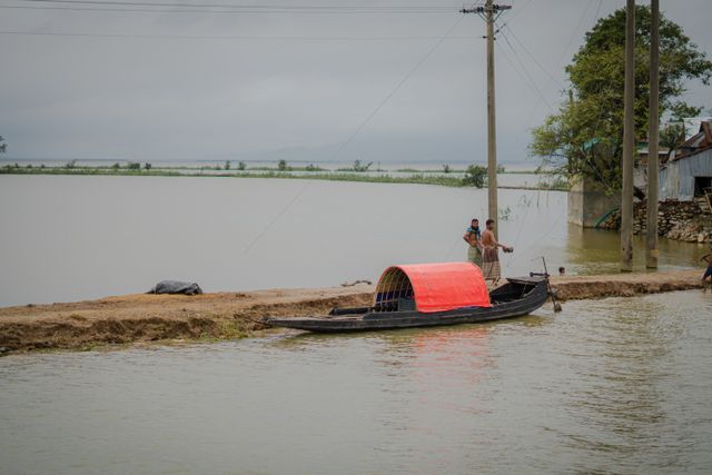
GUWAHATI — The flood situation in Assam shows preliminary signs of stabilization as water levels across major river basins begin to recede. However, the human and economic toll remains severe. According to the latest bulletin from the Assam State Disaster Management Authority (ASDMA), 4,45,495 people remain impacted across six districts.
The cumulative death toll for this wave of monsoon disasters stands at 68, following weeks of flash flooding and river breaches across Upper Assam.
At a Glance: Key Impact Figures
| Metric | Official Count / Estimate |
| Total Affected Population | 4.45+ Lakh citizens |
| Confirmed Death Toll | 68 fatalities |
| Worst-Hit Districts | Charaideo (1.88 lakh), Sivasagar (1.44 lakh), Golaghat, Jorhat, Nagaon, Kamrup (M) |
| Inundated Villages | 631 villages across 21 revenue circles |
| Submerged Crop Area | 37,139.52 hectares |
| Relief Camps Operational | 184 distribution centers & shelter camps |
| Displaced Citizens in Camps | 28,695 inmates (including 97 pregnant/lactating mothers) |
| Livestock Affected | 2.56+ lakh animals (26,000+ washed away or perished) |
Incident Timeline: How the Deluge Unfolded
-
July 18–20, 2026: Intense, localized cloudbursts and torrential rain struck the hill catchments along the Assam–Nagaland border. Districts like Mon in Nagaland received nearly 137 mm of rainfall in 8 to 9 hours.
-
July 21, 2026 (Peak Surge): Runoff surged into Upper Assam’s plains. Rivers like the Dikhou, Disang, and Dhansiri overflowed, breaching multiple embankments within hours.
-
July 24–26, 2026: Over 7 lakh residents were inundated at the peak of the flood. Rescue columns from the Indian Army, NDRF, and SDRF deployed dozens of motorized boats to reach marooned pockets.
-
July 27–28, 2026 (Current Status): Rainfall subsided across the catchment zones. Waters are receding steadily in Sivasagar and Charaideo, though high siltation, power outages, and infrastructure breaches continue to slow down recovery.
What Triggered the Flash Floods?
Unlike typical Brahmaputra overflows that develop over several weeks, the July 2026 disaster was a compound flash flood event. Environmental experts and disaster management officials point to four primary drivers:
-
Extreme Upstream Downpours: Foothill catchments in Nagaland saw localized rainfall up to 493% above seasonal norms over a 48-hour window.
-
Local Cloudburst-like Spells: Sub-districts in Charaideo recorded 170 mm of rainfall (436% above normal), overwhelming natural drainage basins.
-
Overflowing Tributaries: Tributaries flowing down from Nagaland into the Brahmaputra—including the Dikhou, Disang, Burhi Dihing, and Dhansiri—breached embankments in areas with no major flood history.
-
Siltation & Reduced River Capacity: Years of unmanaged forest cover loss and slope erosion upstream brought heavy sediment deposits into riverbeds, drastically reducing their depth and water-carrying capacity.
Relief, Rescue, and Road to Recovery
State authorities and central agencies have intensified relief operations across high-risk districts.
-
Relief Distribution: Over 211 metric tonnes of rice, along with lentils, salt, tarpaulins, and essential medical kits, have been dispatched to relief centers.
-
Health & Sanitation: Medical teams are conducting mobile health checkups in shelter camps to curb the spread of post-flood waterborne diseases.
-
Central Inspection: A four-member Inter-Ministerial Central Team led by the Ministry of Home Affairs has arrived in Assam to conduct on-ground field inspections across Sivasagar, Golaghat, and Jorhat to finalize financial assistance packages.
-
Financial Ex-Gratia: The state government has announced an ex-gratia compensation of ₹4 lakh for the next of kin of each deceased individual.